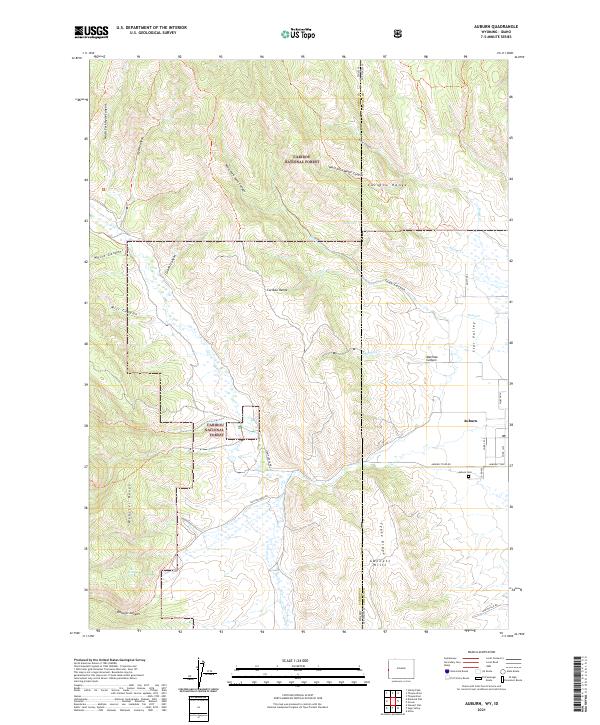
2021 Map of Auburn
USGS Topo · Published 2021About this map
The community of Auburn sits along the state border where the high peaks of the Caribou Range meet the northern reaches of Star Valley. This 2021 survey documents the transition from the irrigated valley floor to the protected slopes of the Caribou National Forest. Local history is centered at the Auburn Cem and along established routes like Auburn-Tygee Rd, which connects the valley to the rugged Gannett Hills to the south. To the west, the landscape is defined by the Webster Range and a network of deep drainage features such as West Fork Toms Canyon and West Fork Water Canyon. The map details the complex terrain where Tygee Ridge and Marthas Canyon dominate the elevation, highlighting the persistent importance of water sources like OE Spring and The Falls in this arid high-country environment.
Find a feature on this map
44 named features on this map. Tap any name to fly to it.
Don’t see what you’re looking for? This feature index may not catch every label — zoom into the map to look around manually.
Map Details
Editions of this 2021 Auburn Map
This is the sole edition of this map. No revisions or reprints were ever made.
Other maps of this area

1915 · Freedom
USGS Topo · 1:62,500

1915 · Crow Creek
USGS Topo · 1:62,500

1921 · Afton
USGS Topo · 1:125,000

1949 · Stewart Flat
USGS Topo · 1:24,000

1951 · Stewart Flat
USGS Topo · 1:24,000

1955 · Preston
USGS Topo · 1:250,000

1958 · Preston
USGS Topo · 1:250,000

1962 · Preston
USGS Topo · 1:250,000
1980 · Grover
USGS Topo · 1:24,000
1980 · Thayne West
USGS Topo · 1:24,000