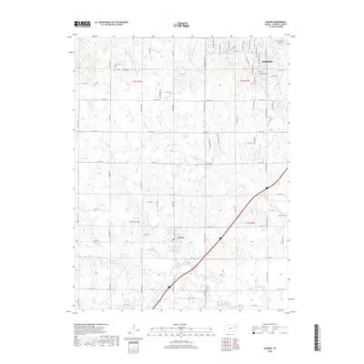
2018 Map of Auburn
USGS Topo · Published 2018About this map
The settlement of Auburn and the southwestern outskirts of Topeka anchor this Shawnee County survey, illustrating the convergence of several major watercourses. The Wakarusa River and its branches, including the N Br Wakarusa River and S Br Wakarusa River, dominate the southern half of the landscape, while the headwaters of Shunganunga Cr and Blacksmith Cr drain the northern terrain. This network of creeks created the natural drainage patterns that have guided the region's agricultural and residential development for generations. For local historians and genealogists, the map identifies three distinct burial sites: Auburn Cem near the town center, Elevation Cem to the northeast, and Somervell Cem further east. The transition from the dense street grid of the state capital to the rural sections near the Sixmile Cr drainage shows the modern footprint of the Kansas prairie.
Find a feature on this map
67 named features on this map. Tap any name to fly to it.
Don’t see what you’re looking for? This feature index may not catch every label — zoom into the map to look around manually.
Map Details
Editions of this 2018 Auburn Map
This is the sole edition of this map. No revisions or reprints were ever made.
Other maps of this area

1889 · Burlingame
USGS Topo · 1:125,000

1889 · Topeka
USGS Topo · 1:125,000

1894 · Burlingame
USGS Topo · 1:125,000

1894 · Topeka
USGS Topo · 1:125,000

1947 · Lawrence
USGS Topo · 1:250,000

1950 · Kansas City
USGS Topo · 1:250,000

1950 · Lawrence
USGS Topo · 1:250,000

1950 · Topeka
USGS Topo · 1:24,000

1951 · Topeka
USGS Topo · 1:24,000

1952 · Auburn
USGS Topo · 1:24,000