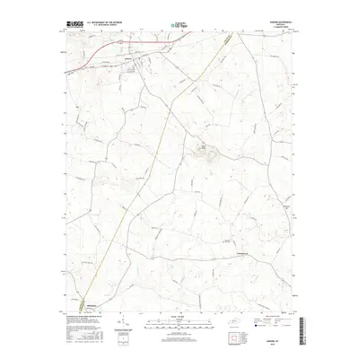
2016 Map of Auburn
USGS Topo · Published 2016About this map
Auburn serves as the primary hub of this Logan County landscape, situated at a junction of regional transit where Byp 68 skirts the northern edge of the historic town grid. The terrain is defined by distinct karst features and rises, most notably Pilot Knob which anchors the central geography between the settlements of Turnertown and the northern residential blocks. To the south, the community of Middleton sits near the border of Logan and Simpson counties, connected by a network of rural routes named for local families, such as David P Hall Rd and J Wilson Rd. Waterways like Black Lick Cr and Spring Cr drain the undulating fields, while Pleasant View Cem reflects the long-standing community roots in this agricultural region. The inclusion of the Old 68 Loop provides a specific look at the evolution of Kentucky's highway system through the local countryside.
Find a feature on this map
71 named features on this map. Tap any name to fly to it.
Don’t see what you’re looking for? This feature index may not catch every label — zoom into the map to look around manually.
Map Details
Editions of this 2016 Auburn Map
This is the sole edition of this map. No revisions or reprints were ever made.
Other maps of this area

1942 · Gallatin
USGS Topo · 1:100,000

1951 · Adairville
USGS Topo · 1:24,000

1951 · Woodburn
USGS Topo · 1:24,000

1951 · Franklin
USGS Topo · 1:24,000

1951 · Prices Mill
USGS Topo · 1:24,000

1951 · Auburn
USGS Topo · 1:24,000

1951 · South Union
USGS Topo · 1:24,000

1951 · Homer
USGS Topo · 1:24,000

1952 · Dennis
USGS Topo · 1:24,000

1952 · Rockfield
USGS Topo · 1:24,000