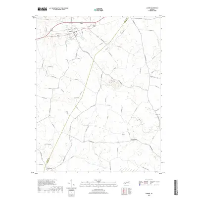
2019 Map of Auburn
USGS Topo · Published 2019About this map
Auburn serves as the primary hub in this portion of South-Central Kentucky, where a detailed street grid including W Main St, E Main St, and S Lincoln St radiates from the town center. The landscape transitions from the developed corridors of the north to the agrarian stretches of the southern Logan and Simpson county line. The topography is punctuated by prominent rises such as Pilot Knob and Prospect Hill, which overlook a network of watercourses including Black Lick Cr and Spring Cr. Smaller settlements like Turnertown and Middleton are connected by a web of rural routes like Morgantown Rd and Holland Rd, reflecting the region's long-standing reliance on road-based transport for its agricultural economy. Genealogists may find interest in the location of the Pleasant View Cem and numerous family-named roads that suggest the historic footprint of local residents.
Find a feature on this map
77 named features on this map. Tap any name to fly to it.
Don’t see what you’re looking for? This feature index may not catch every label — zoom into the map to look around manually.
Map Details
Editions of this 2019 Auburn Map
This is the sole edition of this map. No revisions or reprints were ever made.
Other maps of this area

1942 · Gallatin
USGS Topo · 1:100,000

1951 · Adairville
USGS Topo · 1:24,000

1951 · Woodburn
USGS Topo · 1:24,000

1951 · Franklin
USGS Topo · 1:24,000

1951 · Prices Mill
USGS Topo · 1:24,000

1951 · Auburn
USGS Topo · 1:24,000

1951 · South Union
USGS Topo · 1:24,000

1951 · Homer
USGS Topo · 1:24,000

1952 · Dennis
USGS Topo · 1:24,000

1952 · Rockfield
USGS Topo · 1:24,000