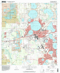
1994 Map of Auburndale
USGS Topo · Published 2000About this map
Auburndale and Winter Haven anchor this landscape of central Florida, where a complex network of freshwater lakes is interspersed with residential expansion and industrial recovery. The western portion of the map is defined by the Tenoroc State Fish Management Area and extensive areas marked as Reclaimed Strip Mine, reflecting the region's history of phosphate mining and subsequent land restoration. These reclaimed sites stand in contrast to the developed urban centers and established neighborhoods like Inwood and Jan-Phyl Village.
Find a feature on this map
77 named features on this map. Tap any name to fly to it.
Don’t see what you’re looking for? This feature index may not catch every label — zoom into the map to look around manually.
Map Details
Editions of this 1994 Auburndale Map
This is the sole edition of this map. No revisions or reprints were ever made.
Other maps of this area

1944 · Providence
USGS Topo · 1:31,680

1944 · Polk City
USGS Topo · 1:31,680

1944 · Lakeland
USGS Topo · 1:31,680

1944 · Auburndale
USGS Topo · 1:31,680

1949 · Mulberry
USGS Topo · 1:24,000

1949 · Bartow
USGS Topo · 1:24,000

1950 · Mulberry
USGS Topo · 1:24,000

1950 · Bartow
USGS Topo · 1:24,000

1955 · Eloise
USGS Topo · 1:24,000

1955 · Orlando
USGS Topo · 1:250,000