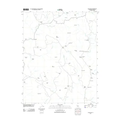
2012 Map of Auckland
USGS Topo · Published 2012About this map
Auckland and its surrounding ranchlands characterize this portion of Tulare County, where the foothills of the Sierra Nevada meet established agricultural and research properties. Large-scale landholdings such as Auckland Ranch, Dudley Ranch, and the M-Bar-J Ranch point to a long-standing ranching economy, while the PacificCoast Equestrian Research Farm indicates more specialized modern land use. The terrain is deeply inscribed by canyons and gulches, including Slickrock Canyon and Murry Gulch, which feed into the complex hydrological system of Cottonwood Cr and Dry Cr. Numerous water sources, such as Schoolhouse Spring, Indian Painting Spring, and Warm Sulphur Spring, are critical markers for local history and resource management in this arid environment. Named landmarks like Buzzard Roost and Ash Spring Mountain provide clear navigational points across a landscape defined by cattle grazing and significant relief.
Find a feature on this map
77 named features on this map. Tap any name to fly to it.
Don’t see what you’re looking for? This feature index may not catch every label — zoom into the map to look around manually.
Map Details
Editions of this 2012 Auckland Map
This is the sole edition of this map. No revisions or reprints were ever made.
Other maps of this area

1903 · Tehipite
USGS Topo · 1:125,000

1904 · Kaweah
USGS Topo · 1:125,000

1905 · Tehipite
USGS Topo · 1:125,000

1909 · Kaweah
USGS Topo · 1:125,000

1921 · Stokes Mountain
USGS Topo · 1:24,000

1922 · Trimmer
USGS Topo · 1:96,000

1924 · Dinuba
USGS Topo · 1:125,000

1924 · Stokes Mountain
USGS Topo · 1:31,680

1926 · Ivanhoe
USGS Topo · 1:31,680

1928 · Lemon Cove
USGS Topo · 1:31,680