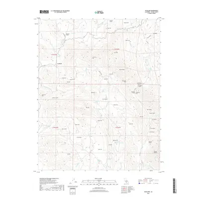
2018 Map of Auckland
USGS Topo · Published 2018About this map
Auckland and the surrounding Tulare County foothills are defined by a complex network of springs and named ridges that supported early ranching and transit. In this high-elevation landscape, water sources like Schoolhouse Spring and the curious mineral waters of Warm Sulphur Spring and Cold Sulphur Spring were vital points of orientation. The map illustrates a transition from the lower valleys toward the higher elevations of Bear Mtn and Ash Spring Mtn. Historical transit routes are evident in the path of Stagecoach Dr, which skirts the eastern edge near Dry Valley. The terrain is deeply segmented by canyons and flats named for early settlers, such as Lucy Runyon Canyon and Bill Moore Ridge, providing a clear record of family names associated with the development of the region's cattle and mining interests.
Find a feature on this map
84 named features on this map. Tap any name to fly to it.
Don’t see what you’re looking for? This feature index may not catch every label — zoom into the map to look around manually.
Map Details
Editions of this 2018 Auckland Map
This is the sole edition of this map. No revisions or reprints were ever made.
Other maps of this area

1903 · Tehipite
USGS Topo · 1:125,000

1904 · Kaweah
USGS Topo · 1:125,000

1905 · Tehipite
USGS Topo · 1:125,000

1909 · Kaweah
USGS Topo · 1:125,000

1921 · Stokes Mountain
USGS Topo · 1:24,000

1922 · Trimmer
USGS Topo · 1:96,000

1924 · Dinuba
USGS Topo · 1:125,000

1924 · Stokes Mountain
USGS Topo · 1:31,680

1926 · Ivanhoe
USGS Topo · 1:31,680

1928 · Lemon Cove
USGS Topo · 1:31,680