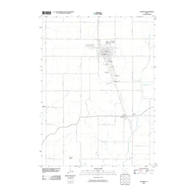
2010 Map of Audubon
USGS Topo · Published 2010About this map
Audubon serves as the central hub of this agricultural landscape in Audubon County, Iowa, where the convergence of Bluegrass Creek and local infrastructure defines the town's character. The map details the civic and cultural life of the community through its recreational landmarks, including the Audubon County Speedway, Audubon County Fairground, and the unique Albert the Bull Campground. Small outlying settlements such as Hamlin, Nishna, and Sharon anchor the surrounding rural grid, which is deeply rooted in the region's heritage.
Find a feature on this map
42 named features on this map. Tap any name to fly to it.
Don’t see what you’re looking for? This feature index may not catch every label — zoom into the map to look around manually.
Map Details
Editions of this 2010 Audubon Map
This is the sole edition of this map. No revisions or reprints were ever made.
Other maps of this area

1954 · Omaha
USGS Topo · 1:250,000

1957 · Omaha
USGS Topo · 1:250,000

1957 · Audubon
USGS Topo · 1:62,500

1958 · Omaha
USGS Topo · 1:250,000

1971 · Viola Center
USGS Topo · 1:24,000

1971 · Gray
USGS Topo · 1:24,000

1978 · Elk Horn
USGS Topo · 1:24,000

1978 · Kimballton
USGS Topo · 1:24,000
1978 · Manning SE
USGS Topo · 1:24,000
1980 · Harlan
USGS Topo · 1:100,000