
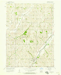
1980 Map of Harlan
USGS Topo · Published 1980About this map
The West Nishnabotna River and Boyer River valleys anchor this 1980 survey, illustrating the agricultural and rail-oriented landscape of western Iowa and eastern Nebraska. The river systems define the region's layout, with major rail lines like the Chicago and North Western and Illinois Central Gulf threading through the loess hills and river bottoms. The map captures the significant transportation corridors connecting settlements like Harlan, Logan, and Missouri Valley at a time when local aviation was well-established, evidenced by the Harlan Municipal Airport and Missouri Valley Airport.
Find a feature on this map
91 named features on this map. Tap any name to fly to it.
Don’t see what you’re looking for? This feature index may not catch every label — zoom into the map to look around manually.
Map Details
Editions of this 1980 Harlan Map
This is the sole edition of this map. No revisions or reprints were ever made.
Other maps of this area

1893 · Omaha
USGS Topo · 1:62,500

1893 · Fremont
USGS Topo · 1:125,000

1896 · Fremont
USGS Topo · 1:125,000

1954 · Omaha
USGS Topo · 1:250,000

1954 · Fort Dodge
USGS Topo · 1:250,000

1955 · Sioux City
USGS Topo · 1:250,000

1955 · Fremont
USGS Topo · 1:250,000
1956 · Underwood
USGS Topo · 1:24,000
1956 · Neola
USGS Topo · 1:24,000

1957 · Fremont
USGS Topo · 1:250,000