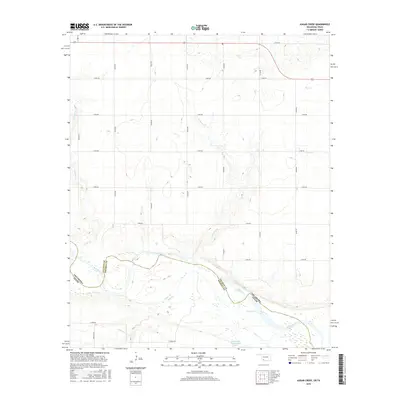
2016 Map of Augar Creek
USGS Topo · Published 2016About this map
The Red River corridor defines this landscape along the state line between Oklahoma and Texas, marking the boundary between Wichita County and Tillman County. The terrain is shaped by a network of drainage systems including the winding Augur Creek, Adams Creek, and China Creek, which feed into the river basin. A notable industrial landmark is the Continental Oil Company Lake, situated near the southern edge of the quadrangle. The area is intersected by a grid of rural routes such as Flippin Road and Moeller Road, illustrating the sparse, agricultural nature of the borderlands during this 2016 survey. The map also records smaller water features like Cooper Creek, Curtis Creek, and Bule Creek, providing a detailed look at the local hydrography as it existed in the early 21st century.
Find a feature on this map
26 named features on this map. Tap any name to fly to it.
Don’t see what you’re looking for? This feature index may not catch every label — zoom into the map to look around manually.
Map Details
Editions of this 2016 Augar Creek Map
This is the sole edition of this map. No revisions or reprints were ever made.
Other maps of this area

1915 · Clara
USGS Topo · 1:24,000

1915 · Barwise School
USGS Topo · 1:24,000

1916 · Electra
USGS Topo · 1:24,000

1918 · Electra
USGS Topo · 1:31,680

1918 · Barwise School
USGS Topo · 1:31,680

1918 · Clara
USGS Topo · 1:31,680

1955 · Lawton
USGS Topo · 1:250,000

1957 · Burkburnett
USGS Topo · 1:62,500

1958 · Electra
USGS Topo · 1:62,500

1962 · Chattanooga
USGS Topo · 1:62,500