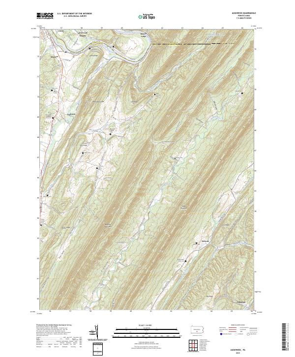
2023 Map of Aughwick
USGS Topo · Published 2023About this map
Blacklog Mountain and Shade Mountain dominate the central landscape of this quadrangle, forming a series of parallel ridges and valleys characteristic of this part of the Appalachian range. Along the northern edge, the Juniata River carves a path through the terrain, accompanied by the Juniata River Water Trl and the settlements of Kistler and Allenport. The map reveals a deeply established rural network defined by its small cemeteries and remote hollows, including Blocks Hollow and Ross Hollow.
Find a feature on this map
73 named features on this map. Tap any name to fly to it.
Don’t see what you’re looking for? This feature index may not catch every label — zoom into the map to look around manually.
Map Details
Editions of this 2023 Aughwick Map
This is the sole edition of this map. No revisions or reprints were ever made.
Other maps of this area

1919 · Mattawana
USGS Topo · 1:62,500

1922 · Mt Union
USGS Topo · 1:48,000

1923 · Shippensburg
USGS Topo · 1:62,500

1924 · Mt. Union
USGS Topo · 1:62,500

1936 · East Waterford
USGS Topo · 1:48,000

1939 · Orbisonia
USGS Topo · 1:62,500

1940 · Orbisonia
USGS Topo · 1:62,500

1941 · East Waterford
USGS Topo · 1:62,500

1943 · Shippensburg
USGS Topo · 1:62,500

1944 · Orbisonia
USGS Topo · 1:62,500