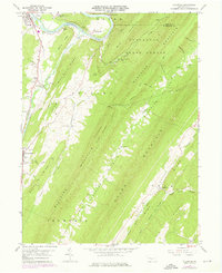
1959 Map of Aughwick
USGS Topo · Published 1976About this map
Shirley Valley and the parallel ridges of Tuscarora Mountain define this central Pennsylvania landscape, where rural communities are tucked into the narrow corridors between Huling Ridge and Shade Mountain. The map details the historic settlement of Shirleysburg, home to the Shirley Home for the Aged and neighboring St Catherine Cem. To the north, the Junata River winds past Allenport and Kistler, while the upland terrain is dominated by the Tuscarora State Forest.
Find a feature on this map
59 named features on this map. Tap any name to fly to it.
Don’t see what you’re looking for? This feature index may not catch every label — zoom into the map to look around manually.
Map Details
Editions of this 1959 Aughwick Map
3 editions found
Other maps of this area

1919 · Mattawana
USGS Topo · 1:62,500

1922 · Mt Union
USGS Topo · 1:48,000

1923 · Shippensburg
USGS Topo · 1:62,500

1924 · Mt. Union
USGS Topo · 1:62,500

1936 · East Waterford
USGS Topo · 1:48,000

1939 · Orbisonia
USGS Topo · 1:62,500

1940 · Orbisonia
USGS Topo · 1:62,500

1941 · East Waterford
USGS Topo · 1:62,500

1943 · Shippensburg
USGS Topo · 1:62,500

1944 · Orbisonia
USGS Topo · 1:62,500
Featured Places
- Shirleysburg, PA
- Lack Township, PA
- Wayne Township, PA
- Richvale, Tell Township
- Aughwick, Shirley Township