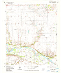
1985 Map of Augur Creek
USGS Topo · Published 1985About this map
Red River silt and sandbars define this borderlands landscape where the Oklahoma-Texas state line follows the winding river channel. The mid-1980s terrain is marked by the confluence of several tributaries, including Augur Creek, China Creek, and Curtis Creek, which cut through the low bluffs of the northern bank. Near a sharp bend in the river, the historic Fort Augur (Site) stands as a marker of 19th-century frontier history in Carr township. To the north, the small settlement of Loveland sits amidst a grid of section lines and rural wells, illustrating the agricultural and resource extraction character of Tillman County. The map clearly delineates the administrative transition between Stephens and Carr, providing a precise view of the geographic boundaries that shaped this part of the Red River valley.
Find a feature on this map
11 named features on this map. Tap any name to fly to it.
Don’t see what you’re looking for? This feature index may not catch every label — zoom into the map to look around manually.
Map Details
Editions of this 1985 Augur Creek Map
This is the sole edition of this map. No revisions or reprints were ever made.
Other maps of this area

1915 · Clara
USGS Topo · 1:24,000

1915 · Barwise School
USGS Topo · 1:24,000

1916 · Electra
USGS Topo · 1:24,000

1918 · Electra
USGS Topo · 1:31,680

1918 · Barwise School
USGS Topo · 1:31,680

1918 · Clara
USGS Topo · 1:31,680

1955 · Lawton
USGS Topo · 1:250,000

1957 · Burkburnett
USGS Topo · 1:62,500

1958 · Electra
USGS Topo · 1:62,500

1962 · Chattanooga
USGS Topo · 1:62,500