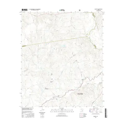
2016 Map of Augusta
USGS Topo · Published 2016About this map
Augusta and the surrounding piney woods of Houston County are depicted here near the confluence of several creeks and the Neches River. This corner of East Texas is defined by a dense network of country roads, such as Co RD 1680 and FM 227, which connect small communities and family-named landmarks. The landscape is dotted with several family and community burial grounds, including the John Sheridan Grave, Bobbitt Cem, and the Davis Family Cem, providing significant clues for genealogists and local historians tracing early settlers.
Find a feature on this map
70 named features on this map. Tap any name to fly to it.
Don’t see what you’re looking for? This feature index may not catch every label — zoom into the map to look around manually.
Map Details
Editions of this 2016 Augusta Map
This is the sole edition of this map. No revisions or reprints were ever made.
Other maps of this area

1946 · Alto
USGS Topo · 1:62,500

1950 · Crockett NE
USGS Topo · 1:24,000

1950 · Ratcliff
USGS Topo · 1:24,000

1951 · Grapeland
USGS Topo · 1:24,000

1951 · Crockett NE
USGS Topo · 1:24,000

1951 · Ratcliff
USGS Topo · 1:24,000

1952 · Slocum
USGS Topo · 1:62,500

1953 · Palestine
USGS Topo · 1:250,000

1957 · Palestine
USGS Topo · 1:250,000
1973 · Pryor Mountain
USGS Topo · 1:24,000