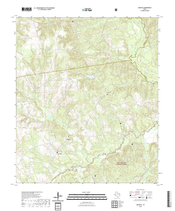
2022 Map of Augusta
USGS Topo · Published 2022About this map
The community of Augusta serves as a central anchor in this East Texas landscape, situated near the headwaters of several drainages including Sillege Cr and San Pedro Cr. The area is characterized by a significant density of family and community burial grounds, such as the Augusta Cem, Post Oak Cem, and the Davis Family Cem, providing a clear record of local lineage in Houston County. To the southeast, the terrain transitions into the protected timberlands of the Davy Crockett National Forest, where the topography becomes more complex around Copperas Br and Babbitt Lake. The northern and eastern boundaries are defined by the convergence of Anderson, Cherokee, and Houston counties, with the Neches River marking the far northeastern corner. This survey documents the persistent rural character of the region, where numerous county roads like Co Rd 1211 and state routes like FM 228 connect isolated settlements and family landholdings.
Find a feature on this map
69 named features on this map. Tap any name to fly to it.
Don’t see what you’re looking for? This feature index may not catch every label — zoom into the map to look around manually.
Map Details
Editions of this 2022 Augusta Map
This is the sole edition of this map. No revisions or reprints were ever made.
Other maps of this area

1946 · Alto
USGS Topo · 1:62,500

1950 · Crockett NE
USGS Topo · 1:24,000

1950 · Ratcliff
USGS Topo · 1:24,000

1951 · Grapeland
USGS Topo · 1:24,000

1951 · Crockett NE
USGS Topo · 1:24,000

1951 · Ratcliff
USGS Topo · 1:24,000

1952 · Slocum
USGS Topo · 1:62,500

1953 · Palestine
USGS Topo · 1:250,000

1957 · Palestine
USGS Topo · 1:250,000
1973 · Pryor Mountain
USGS Topo · 1:24,000