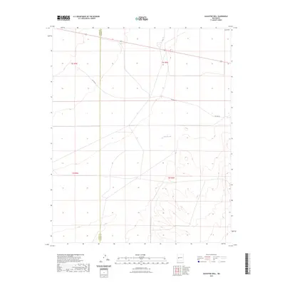
2023 Map of Augustine Well
USGS Topo · Published 2023About this map
The high-elevation plains of the San Agustin region are captured in this 2023 survey, centered on the boundary between Catron and Socorro counties. The terrain is characterized by the broad, open basin of the plains, punctuated by features like Clements Lake and the shifting elevations of the Sand Hills in the northeast corner. This map documents a transitional landscape where modern infrastructure meets historic travel routes. While modern Highway 60 cuts across the northern sections, the trace of Old Hwy 60 remains visible as it winds through the center of the sheet, providing a clear record of how the transportation network has shifted over decades of development in this part of New Mexico.
Find a feature on this map
11 named features on this map. Tap any name to fly to it.
Don’t see what you’re looking for? This feature index may not catch every label — zoom into the map to look around manually.
Map Details
Editions of this 2023 Augustine Well Map
This is the sole edition of this map. No revisions or reprints were ever made.
Other maps of this area

1954 · Tularosa
USGS Topo · 1:250,000

1954 · Socorro
USGS Topo · 1:250,000

1958 · Socorro
USGS Topo · 1:250,000

1958 · Tularosa
USGS Topo · 1:250,000

1962 · Socorro
USGS Topo · 1:250,000

1963 · Anderson Peak
USGS Topo · 1:24,000

1963 · Datil
USGS Topo · 1:24,000

1964 · Arrowhead Well
USGS Topo · 1:24,000

1964 · Monica Saddle
USGS Topo · 1:24,000

1964 · Lion Mountain
USGS Topo · 1:24,000