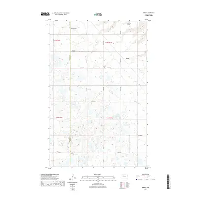
2020 Map of Aurelia
USGS Topo · Published 2020About this map
The small settlement of Aurelia sits at a crossroads in the northern Great Plains, defined by a landscape of prairie potholes and agricultural section lines. This North Dakota survey documents a rural environment where the township and range system is strictly maintained by roads like 408th St NW and 212th Ave NW. Local history is anchored by the Aurelia Community Cem, while the terrain is marked by seasonal drainages including Bowman Coulee, Shipton Coulee, and Jack Power Coulee. The boundary between Mountrail County and Ward County bisects the western portion of the map, illustrating the administrative divisions that govern these farming communities. The numerous small wetlands scattered across the quadrangle highlight the region's post-glacial topography, which influences both field patterns and the path of routes like Co Hwy 6.
Find a feature on this map
30 named features on this map. Tap any name to fly to it.
Don’t see what you’re looking for? This feature index may not catch every label — zoom into the map to look around manually.
Map Details
Editions of this 2020 Aurelia Map
This is the sole edition of this map. No revisions or reprints were ever made.
Other maps of this area

1947 · Tolley
USGS Topo · 1:62,500

1948 · Donnybrook
USGS Topo · 1:24,000

1949 · Tolley SE
USGS Topo · 1:24,000

1949 · Hartland
USGS Topo · 1:24,000

1949 · Coulee
USGS Topo · 1:24,000

1950 · Kenmare
USGS Topo · 1:62,500

1950 · Tolley
USGS Topo · 1:62,500

1953 · Williston
USGS Topo · 1:250,000

1954 · Minot
USGS Topo · 1:250,000

1957 · Williston
USGS Topo · 1:250,000