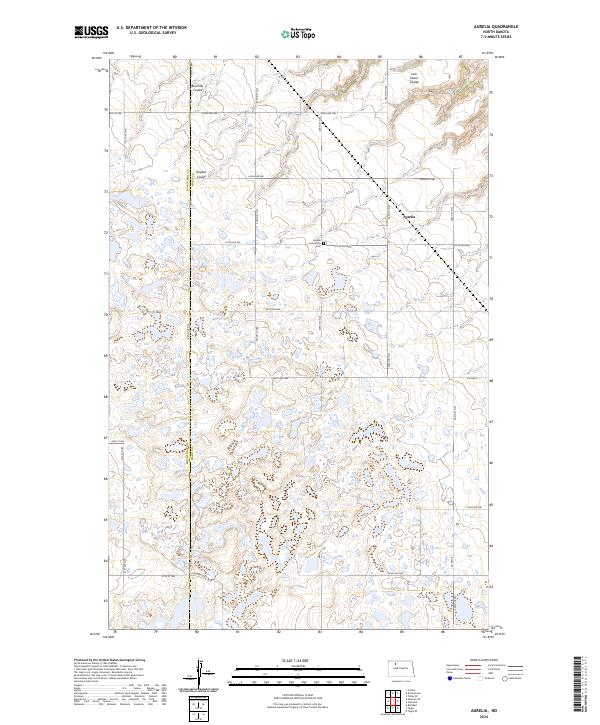
2024 Map of Aurelia
USGS Topo · Published 2024About this map
Aurelia stands at the heart of this prairie landscape, where the small settlement and nearby Aurelia Community Cem serve as focal points for the surrounding rural community. The topography is defined by the drainage patterns of Bowman Coulee, Shipton Coulee, and Jack Power Coulee, which carve through the high plains. A significant portion of the region is dedicated to wildlife conservation, represented by the Mountrail County Waterfowl Production Area and the Ward County Waterfowl Production Area. These protected wetlands and grasslands underscore the area's importance to the migratory paths and breeding grounds of the Central Flyway. The map also delineates the jurisdictional boundary between Mountrail and Ward Counties, following a precise grid of section lines and gravel roads that connect remote farmsteads.
Find a feature on this map
24 named features on this map. Tap any name to fly to it.
Don’t see what you’re looking for? This feature index may not catch every label — zoom into the map to look around manually.
Map Details
Editions of this 2024 Aurelia Map
This is the sole edition of this map. No revisions or reprints were ever made.
Other maps of this area

1947 · Tolley
USGS Topo · 1:62,500

1948 · Donnybrook
USGS Topo · 1:24,000

1949 · Tolley SE
USGS Topo · 1:24,000

1949 · Hartland
USGS Topo · 1:24,000

1949 · Coulee
USGS Topo · 1:24,000

1950 · Kenmare
USGS Topo · 1:62,500

1950 · Tolley
USGS Topo · 1:62,500

1953 · Williston
USGS Topo · 1:250,000

1954 · Minot
USGS Topo · 1:250,000

1957 · Williston
USGS Topo · 1:250,000