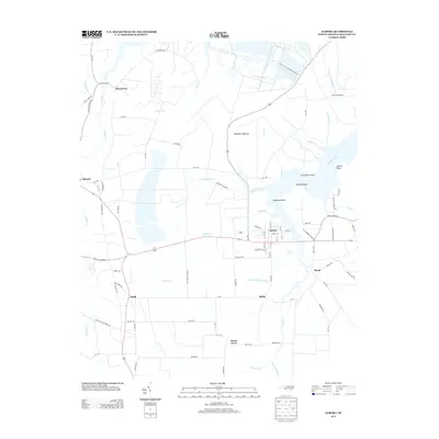
2013 Map of Aurora
USGS Topo · Published 2013About this map
Aurora serves as the primary hub of this Beaufort County landscape, situated near the headwaters of several coastal tributaries. The northern reaches of the map are defined by the massive Texasgulf Phosphate Operation, a significant industrial footprint that neighbors the wide waters of South Creek. The surrounding area is a network of small, rural settlements and points, including Bonnerton, Edward, and Small, each linked by a grid of local roads and state routes like NC-33.
Find a feature on this map
87 named features on this map. Tap any name to fly to it.
Don’t see what you’re looking for? This feature index may not catch every label — zoom into the map to look around manually.
Map Details
Editions of this 2013 Aurora Map
This is the sole edition of this map. No revisions or reprints were ever made.
Other maps of this area

1950 · Vandemere
USGS Topo · 1:24,000

1950 · South Creek
USGS Topo · 1:24,000

1950 · Aurora
USGS Topo · 1:24,000

1950 · Edward
USGS Topo · 1:24,000

1951 · Bath
USGS Topo · 1:24,000

1951 · Ransomville
USGS Topo · 1:24,000

1953 · Blounts Bay
USGS Topo · 1:24,000

1953 · Rocky Mount
USGS Topo · 1:250,000

1954 · Rocky Mount
USGS Topo · 1:250,000
1968 · Bayboro
USGS Topo · 1:24,000