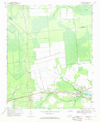
1968 Map of Bayboro
USGS Topo · Published 1970About this map
Bayboro serves as the focal point of this coastal landscape, situated at the confluence where the North Prong and South Prong meet to form the Bay River. The late 1960s environment is defined by a heavy reliance on managed water systems, evidenced by numerous man-made features such as New Ditch Road and several unnamed canals that drain the low-lying timber and agricultural lands near Gum Swamp. Transport and industry are anchored by the Norfolk Southern railroad, which threads through the settlements of Grantsboro and Alliance. Local community life is rooted in scattered rural centers, marked by landmarks like the Rock of Zion Ch and West Branch Ch, while the transition from Beaufort County into Pamlico County is clearly delineated across the northern marshes and creeks.
Find a feature on this map
37 named features on this map. Tap any name to fly to it.
Don’t see what you’re looking for? This feature index may not catch every label — zoom into the map to look around manually.
Map Details
Editions of this 1968 Bayboro Map
Other maps of this area

1948 · Oriental
USGS Topo · 1:24,000

1950 · Vandemere
USGS Topo · 1:24,000

1950 · South Creek
USGS Topo · 1:24,000

1950 · Aurora
USGS Topo · 1:24,000

1950 · Edward
USGS Topo · 1:24,000

1950 · Upper Broad Creek
USGS Topo · 1:24,000

1950 · Arapahoe
USGS Topo · 1:24,000

1951 · Arapahoe
USGS Topo · 1:24,000

1951 · Upper Broad Creek
USGS Topo · 1:24,000

1953 · Rocky Mount
USGS Topo · 1:250,000