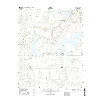
2016 Map of Aurora
USGS Topo · Published 2016About this map
The town of Aurora serves as the focal point of this coastal plain landscape in Beaufort County, where a grid of rural roads connects several small communities including Edward, Bonnerton, and Idalia. The terrain is defined by its proximity to the Pamlico River estuary system, evidenced by the numerous creek networks such as Whitehurst Cr and Durham Creek. The map provides significant genealogical value through the identification of family-named landmarks and resting places, including Bonner Cem, Rowe Cem, and Oakhaven Cem. Between the settled areas of Small and Royal, the land opens into the ecologically distinct Beacham Savanna, while the shoreline is marked by prominent landforms like Silverthorn Point and Deephole Point. This map illustrates the 21st-century configuration of a region defined by its reliance on well-established local routes like Old Sandhill Rd and Tunstall Swamp Rd.
Find a feature on this map
72 named features on this map. Tap any name to fly to it.
Don’t see what you’re looking for? This feature index may not catch every label — zoom into the map to look around manually.
Map Details
Editions of this 2016 Aurora Map
This is the sole edition of this map. No revisions or reprints were ever made.
Other maps of this area

1950 · Vandemere
USGS Topo · 1:24,000

1950 · South Creek
USGS Topo · 1:24,000

1950 · Aurora
USGS Topo · 1:24,000

1950 · Edward
USGS Topo · 1:24,000

1951 · Bath
USGS Topo · 1:24,000

1951 · Ransomville
USGS Topo · 1:24,000

1953 · Blounts Bay
USGS Topo · 1:24,000

1953 · Rocky Mount
USGS Topo · 1:250,000

1954 · Rocky Mount
USGS Topo · 1:250,000
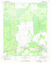
1968 · Bayboro
USGS Topo · 1:24,000