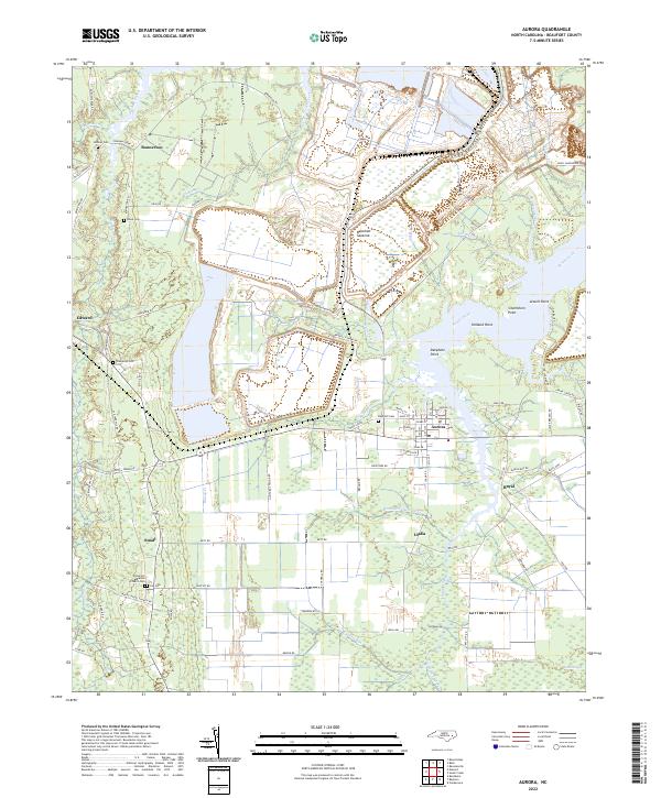
2022 Map of Aurora
USGS Topo · Published 2022About this map
South Creek and its many finger-like tributaries, including Whitehurst Cr, Jacks Cr, and Jacobs Cr, define the wet, low-lying landscape of this Beaufort County coastal plain. The town of Aurora serves as the central hub, surrounded by a network of smaller rural communities like Royal, Idalia, and Bonnerton. The survey reveals an extensive grid of drainage canals and agricultural roads that support the region's timber and farming interests, especially around the Beacham Savanna. Genealogists will find significant value in the numerous family and church burial grounds scattered across the township, such as High Hill Cem, Lee Cem, Oakhaven Cem, and the White Hill Baptist Church Cem. These sites, often located near historic crossroads like Small or along rural routes like Durham Creek Rd, provide a window into the settlement patterns and family histories of this portion of the North Carolina tidewater.
Find a feature on this map
87 named features on this map. Tap any name to fly to it.
Don’t see what you’re looking for? This feature index may not catch every label — zoom into the map to look around manually.
Map Details
Editions of this 2022 Aurora Map
This is the sole edition of this map. No revisions or reprints were ever made.
Other maps of this area

1950 · Vandemere
USGS Topo · 1:24,000

1950 · South Creek
USGS Topo · 1:24,000

1950 · Aurora
USGS Topo · 1:24,000

1950 · Edward
USGS Topo · 1:24,000

1951 · Bath
USGS Topo · 1:24,000

1951 · Ransomville
USGS Topo · 1:24,000

1953 · Blounts Bay
USGS Topo · 1:24,000

1953 · Rocky Mount
USGS Topo · 1:250,000

1954 · Rocky Mount
USGS Topo · 1:250,000
1968 · Bayboro
USGS Topo · 1:24,000