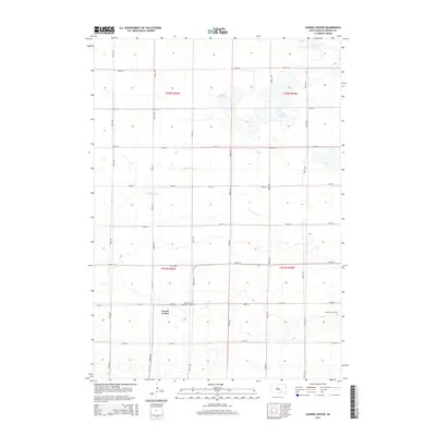
2015 Map of Aurora Center
USGS Topo · Published 2015About this map
The small settlement of Aurora Center serves as the focal point of this rural prairie landscape in Aurora County. The township is characterized by a strict section-line grid of roads, including 381st Ave and 266th St, which navigate the subtle topography of the Great Plains. Water features are concentrated in the northern sections, notably the elongated Horse Shoe Lake and Pleasant Lake, which punctuate the agricultural expanse. The drainage of the E Fork Platte Cr meanders across the central portion of the map, illustrating the natural watercourses that predate the systematic road network. Local history is anchored by the presence of the Quaker Cem and the Aurora Center Cem, providing vital points of reference for genealogists and researchers studying the early families of Truro Township.
Find a feature on this map
24 named features on this map. Tap any name to fly to it.
Don’t see what you’re looking for? This feature index may not catch every label — zoom into the map to look around manually.
Map Details
Editions of this 2015 Aurora Center Map
This is the sole edition of this map. No revisions or reprints were ever made.
Other maps of this area

1899 · Mitchell
USGS Topo · 1:125,000

1955 · Mitchell
USGS Topo · 1:250,000

1959 · Mitchell
USGS Topo · 1:250,000

1979 · New Holland
USGS Topo · 1:24,000

1979 · Laffey Lake
USGS Topo · 1:24,000

1979 · Crystal Lake
USGS Topo · 1:24,000

1979 · White Lake
USGS Topo · 1:24,000

1979 · Aurora Center
USGS Topo · 1:24,000

1979 · Joubert
USGS Topo · 1:24,000

1980 · Stickney
USGS Topo · 1:24,000
Featured Places
- Truro Township, SD
- Crystal Lake Township, SD
- Pleasant Lake Township, SD
- Center Township, SD
- Aurora Center, SD