
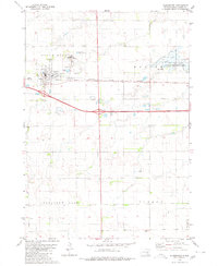
1979 Map of Aurora Center
USGS Topo · Published 1980About this map
Aurora Center and the surrounding agricultural landscape of Center and Truro townships are defined by a series of prairie lakes and wetlands captured in this 1970s survey. The map details a region transitioning between managed waterfowl habitats and active farmland, featuring large protected zones such as the Pleasant Lake State Public Shooting Area and Hanson Lake State Public Shooting Area. These areas surround notable water bodies including Crystal Lake, Pleasant Lake, and Horseshoe Lake.
Find a feature on this map
15 named features on this map. Tap any name to fly to it.
Don’t see what you’re looking for? This feature index may not catch every label — zoom into the map to look around manually.
Map Details
Editions of this 1979 Aurora Center Map
This is the sole edition of this map. No revisions or reprints were ever made.
Other maps of this area

1899 · Mitchell
USGS Topo · 1:125,000

1955 · Mitchell
USGS Topo · 1:250,000

1959 · Mitchell
USGS Topo · 1:250,000

1979 · New Holland
USGS Topo · 1:24,000

1979 · Laffey Lake
USGS Topo · 1:24,000

1979 · Crystal Lake
USGS Topo · 1:24,000

1979 · White Lake
USGS Topo · 1:24,000

1979 · Joubert
USGS Topo · 1:24,000

1980 · Stickney
USGS Topo · 1:24,000
1980 · Plankinton
USGS Topo · 1:24,000
Featured Places
- Pleasant Lake Township, SD
- Aurora Center, SD
- Truro Township, SD
- Crystal Lake Township, SD
- Center Township, SD