
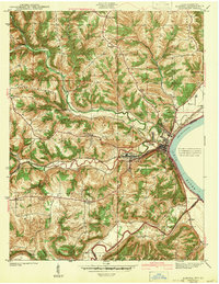
1943 Map of Aurora
USGS Topo · Published 1943About this map
The Ohio River shoreline anchors this 1940 survey, where the town of Aurora and the industrial pocket of Cochran sit at the confluence of several major drainage systems. The landscape is defined by the Baltimore and Ohio railroad corridor, which follows the winding path of South Hogan Creek through the interior. Social and community life in this era is centered around numerous country schools and churches, such as Mt Sinai Ch on the western ridges and Ebenezer Ch to the north. Smaller rural hubs like Wilmington and Kirschs Corner are linked by a network of roads traversing high ground like Possum Ridge and Short Ridge. The mapping also captures specialized community landmarks including the Pleasant View Grange and the small settlement of Buffalo near Laughery Creek.
Find a feature on this map
38 named features on this map. Tap any name to fly to it.
Don’t see what you’re looking for? This feature index may not catch every label — zoom into the map to look around manually.
Map Details
Editions of this 1943 Aurora Map
2 editions found
Other maps of this area

1915 · Lawrenceburg
USGS Topo · 1:48,000

1928 · Lawrenceburg
USGS Topo · 1:62,500

1932 · Lawrenceburg
USGS Topo · 1:62,500

1943 · Aberdeen
USGS Topo · 1:24,000

1943 · Rising Sun
USGS Topo · 1:24,000

1943 · Hooven
USGS Topo · 1:24,000

1943 · Guilford
USGS Topo · 1:24,000

1943 · Lawrenceburg
USGS Topo · 1:24,000

1951 · Rising Sun
USGS Topo · 1:24,000

1953 · Aberdeen
USGS Topo · 1:24,000