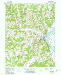
1981 Map of Aurora
USGS Topo · Published 1982About this map
Aurora and Lawrenceburg dominate the riverfront landscape in the early 1980s, where the winding Ohio River forms the state boundary between Indiana and Kentucky. This survey captures a highly developed industrial and transportation corridor, anchored by the Baltimore and Ohio Railroad and infrastructure like the Pumping Sta and Sewage Disposal facilities. Away from the river, the terrain rises sharply into a series of named ridges, including Ebenezer Ridge and Wilmington Ridge, which dictate the placement of local roads and smaller communities like Kirschs Corner and Mount Sinai. Educational and civic landmarks, such as South Dearborn High Sch and the Aurora Industrial Airfield, reflect the region's mid-century growth. Genealogists may find value in the specific locations of rural congregations and burial grounds like Mt Tabor Ch and Riverview Cem situated along the creeks and hollows.
Find a feature on this map
62 named features on this map. Tap any name to fly to it.
Don’t see what you’re looking for? This feature index may not catch every label — zoom into the map to look around manually.
Map Details
Editions of this 1981 Aurora Map
2 editions found
Other maps of this area

1915 · Lawrenceburg
USGS Topo · 1:48,000

1928 · Lawrenceburg
USGS Topo · 1:62,500

1932 · Lawrenceburg
USGS Topo · 1:62,500

1943 · Aberdeen
USGS Topo · 1:24,000

1943 · Aurora
USGS Topo · 1:24,000

1943 · Rising Sun
USGS Topo · 1:24,000

1943 · Hooven
USGS Topo · 1:24,000

1943 · Guilford
USGS Topo · 1:24,000

1943 · Lawrenceburg
USGS Topo · 1:24,000

1951 · Rising Sun
USGS Topo · 1:24,000