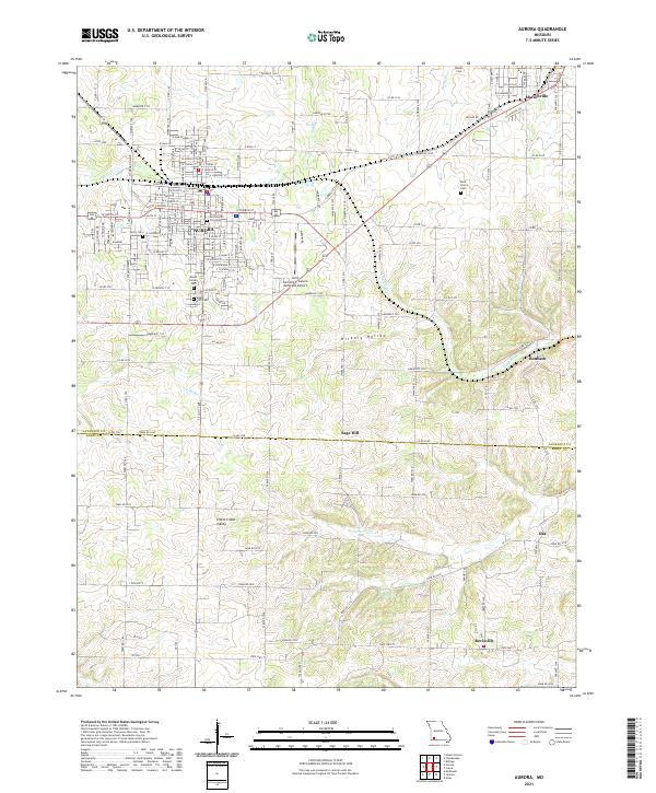
2021 Map of Aurora
USGS Topo · Published 2021About this map
Aurora and Marionville anchor this survey of the Missouri Ozark Plateau, where the headwaters of the Spring River and Crane Creek begin their descent through the rolling landscape. The town of Aurora displays a dense grid of streets and numerous community landmarks, including the Berry Cemetery, Maple Park Cemetery, and Aurora-Old City Cemetery. The Missouri & Northern Arkansas RR cuts across the northern half of the region, passing through the eastern settlement of Marionville and connecting the area's agricultural and municipal centers.
Find a feature on this map
61 named features on this map. Tap any name to fly to it.
Don’t see what you’re looking for? This feature index may not catch every label — zoom into the map to look around manually.
Map Details
Editions of this 2021 Aurora Map
This is the sole edition of this map. No revisions or reprints were ever made.
Other maps of this area

1886 · Greenfield
USGS Topo · 1:125,000

1888 · Greenfield
USGS Topo · 1:125,000

1919 · Halltown
USGS Topo · 1:62,500

1921 · Stotts City
USGS Topo · 1:62,500

1942 · Aurora
USGS Topo · 1:62,500

1943 · Monett
USGS Topo · 1:62,500

1945 · Harrison
USGS Topo · 1:250,000

1945 · Aurora
USGS Topo · 1:62,500

1949 · Harrison
USGS Topo · 1:250,000

1954 · Harrison
USGS Topo · 1:250,000