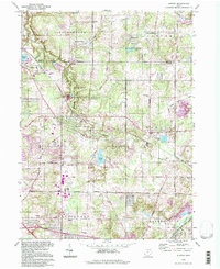
1994 Map of Aurora
USGS Topo · Published 1997About this map
Aurora serves as the focal point of this late 20th-century landscape, situated within the historic Connecticut Western Reserve. The terrain is characterized by a high density of water features, from the substantial Akron City Reservoir and Sunny Lake to the protected corridor of the Upper Cuyahoga State Scenic River in the southeast corner. Small settlements and residential clusters like Taborville, Spring Valley, and Beartown are scattered throughout the township boundaries, reflecting the area's transition from rural townships into more developed suburban communities. Local institutions including The Country Ch and the Waite Sch anchor these neighborhoods.
Find a feature on this map
42 named features on this map. Tap any name to fly to it.
Don’t see what you’re looking for? This feature index may not catch every label — zoom into the map to look around manually.
Map Details
Editions of this 1994 Aurora Map
This is the sole edition of this map. No revisions or reprints were ever made.
Other maps of this area

1905 · Garrettsville
USGS Topo · 1:62,500

1906 · Kent
USGS Topo · 1:62,500

1906 · Chagrin Falls
USGS Topo · 1:62,500

1906 · Ravenna
USGS Topo · 1:62,500

1907 · Garrettsville
USGS Topo · 1:62,500

1908 · Chagrin Falls
USGS Topo · 1:62,500

1908 · Ravenna
USGS Topo · 1:62,500

1950 · Cleveland
USGS Topo · 1:250,000

1953 · South Russell
USGS Topo · 1:24,000

1953 · Aurora
USGS Topo · 1:24,000