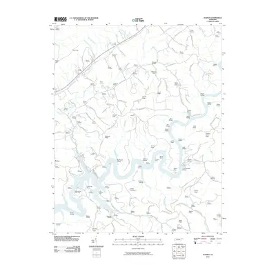
2010 Map of Ausmus
USGS Topo · Published 2010About this map
Powell River meanders through this portion of Claiborne County, creating dramatic topographic shifts at Wilson Bend and Bostic Bend. The landscape is a complex network of ridges and hollows, including Chestnut Grove Ridge and Tony Hollow, where isolated settlements and family burial grounds are common. This map documents a history of resource extraction near the river, evidenced by the Caldwell Mine and the New Prospect Mine, as well as the Stiner Prospects near Leadmine Bend Creek.
Find a feature on this map
140 named features on this map. Tap any name to fly to it.
Don’t see what you’re looking for? This feature index may not catch every label — zoom into the map to look around manually.
Map Details
Editions of this 2010 Ausmus Map
This is the sole edition of this map. No revisions or reprints were ever made.
Other maps of this area

1886 · Cumberland Gap
USGS Topo · 1:125,000

1888 · Cumberland Gap
USGS Topo · 1:125,000

1891 · Cumberland Gap
USGS Topo · 1:125,000

1897 · Maynardville
USGS Topo · 1:125,000

1900 · Maynardville
USGS Topo · 1:125,000

1903 · Middlesboro
USGS Topo · 1:48,000

1927 · Middlesboro
USGS Topo · 1:62,500

1930 · Middlesboro
USGS Topo · 1:62,500

1935 · Mingo Mountains
USGS Topo · 1:24,000

1935 · Cumberland Gap
USGS Topo · 1:24,000