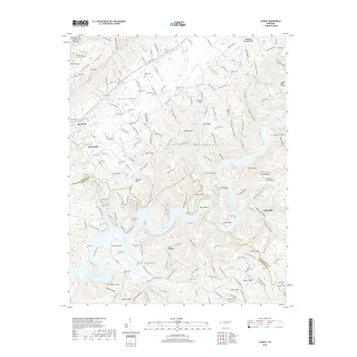
2019 Map of Ausmus
USGS Topo · Published 2019About this map
Powell Valley serves as a central corridor in this northern Tennessee landscape, where the dramatic terrain of Cumberland Mountain meets the winding waters of the Powell River. The map highlights a rural pattern of development focused around small crossroads and creek drainages, with Speedwell and Yoakum Crossroad anchoring the northern reaches. The river's serpentine path creates deep peninsulas like Leadmine Bend, bounded by significant topographic features such as Devils Backbone and Whiteoak Ridge. Genealogists will find a high density of family-named cemeteries, including Shoffner Cem, Keck Cem, and Lundy Cem, which speak to the long-standing community ties in this corner of Claiborne and Union counties. The inclusion of the Cumberland Trail and various hollows, from Happy Hollow to Greasy Hollow, illustrates the varied relief and historical transit routes of the region.
Find a feature on this map
145 named features on this map. Tap any name to fly to it.
Don’t see what you’re looking for? This feature index may not catch every label — zoom into the map to look around manually.
Map Details
Editions of this 2019 Ausmus Map
This is the sole edition of this map. No revisions or reprints were ever made.
Other maps of this area

1886 · Cumberland Gap
USGS Topo · 1:125,000

1888 · Cumberland Gap
USGS Topo · 1:125,000

1891 · Cumberland Gap
USGS Topo · 1:125,000

1897 · Maynardville
USGS Topo · 1:125,000

1900 · Maynardville
USGS Topo · 1:125,000

1903 · Middlesboro
USGS Topo · 1:48,000

1927 · Middlesboro
USGS Topo · 1:62,500

1930 · Middlesboro
USGS Topo · 1:62,500

1935 · Mingo Mountains
USGS Topo · 1:24,000

1935 · Cumberland Gap
USGS Topo · 1:24,000