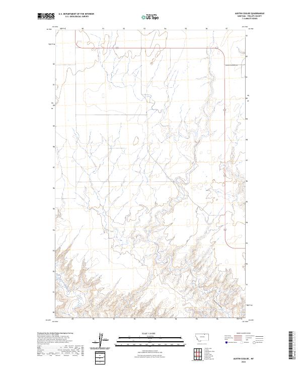
2024 Map of Austin Coulee
USGS Topo · Published 2024About this map
Austin Coulee and Little Cottonwood Creek define the drainage patterns of this Phillips County landscape, where the open prairie is partitioned by the rigid lines of the Public Land Survey System. This modern topographic study reveals a terrain of subtle elevation changes and coulees that have historically dictated the movement of livestock and the placement of rural infrastructure. The presence of Loring Cutacross Rd in the northeastern corner highlights the connectivity required in this sparsely settled region, linking remote ranching tracts. The map provides a detailed view of the township and range grid, including t35n r30e and t34n r30e, which remain foundational to land ownership and agricultural management in this part of Montana.
Find a feature on this map
9 named features on this map. Tap any name to fly to it.
Don’t see what you’re looking for? This feature index may not catch every label — zoom into the map to look around manually.
Map Details
Editions of this 2024 Austin Coulee Map
This is the sole edition of this map. No revisions or reprints were ever made.
Other maps of this area

1920 · Cowan
USGS Topo · 1:125,000

1954 · Glasgow
USGS Topo · 1:250,000

1957 · Glasgow
USGS Topo · 1:250,000

1958 · Glasgow
USGS Topo · 1:250,000

1968 · Austin Lake
USGS Topo · 1:24,000

1968 · Hewitt Lake SW
USGS Topo · 1:24,000
1984 · Garland Creek
USGS Topo · 1:24,000

1984 · Austin Coulee
USGS Topo · 1:24,000

1984 · Whitewater West
USGS Topo · 1:24,000
1984 · Fanny Hill
USGS Topo · 1:24,000