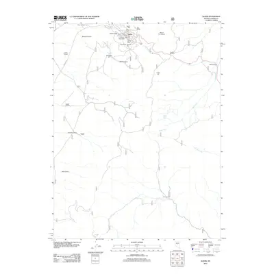
2012 Map of Austin
USGS Topo · Published 2012About this map
Austin serves as the focal point of this high-desert landscape, tucked among the steep canyons and peaks of the Toiyabe Range. The town's historical foundations in silver mining are evidenced by the presence of industrial landmarks like the Duff and Company Mill and Ralstons Mill. Higher on the slopes, the distinctive Stokes Castle stands above Cedar Ravine, while the Clifton Tunnel and Austin Post Office mark the civic and infrastructure center of the community. Beyond the settlement, the terrain transitions into a system of named basins and canyons, including Marshall Basin and Johnson Canyon. Cattle ranching and water management define the outlying areas, with the Johnson Ranch and Arena Ranch situated along seasonal drainages like Bade Creek and Blackbird Creek. This 2012 survey captures the enduring layout of one of Nevada's most storied mining districts in its modern context.
Find a feature on this map
31 named features on this map. Tap any name to fly to it.
Don’t see what you’re looking for? This feature index may not catch every label — zoom into the map to look around manually.
Map Details
Editions of this 2012 Austin Map
This is the sole edition of this map. No revisions or reprints were ever made.
Other maps of this area

1926 · Roberts Mountains
USGS Topo · 1:250,000

1929 · Roberts Mountains
USGS Topo · 1:250,000

1955 · Millett
USGS Topo · 1:250,000

1956 · Mount Callaghan
USGS Topo · 1:62,500

1956 · Austin
USGS Topo · 1:62,500

1959 · Millett
USGS Topo · 1:250,000

1960 · Spencer Hot Springs
USGS Topo · 1:62,500

1969 · Yankee Blade
USGS Topo · 1:24,000

1969 · Vigus Butte
USGS Topo · 1:24,000

1978 · Summit Mountain
USGS Topo · 1:100,000