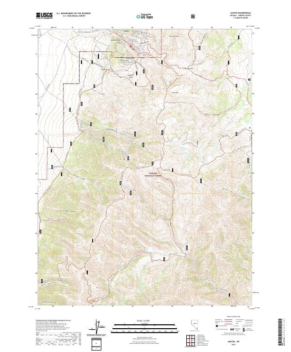
2021 Map of Austin
USGS Topo · Published 2021About this map
The silver-mining legacy of Austin is etched into the steep terrain of China Ridge and Mt Prometheus in the heart of the Toiyabe Range. This 2021 study shows the modern footprint of the historic settlement, including the iconic stone landmark Stokes Castle overlooking the Reese River Valley. The surrounding landscape within the Toiyabe National Forest is defined by a dense network of trails and ridges, such as Cahill Canyon and Union Hill, that trace the paths of nineteenth-century miners and modern explorers alike.
Find a feature on this map
67 named features on this map. Tap any name to fly to it.
Don’t see what you’re looking for? This feature index may not catch every label — zoom into the map to look around manually.
Map Details
Editions of this 2021 Austin Map
This is the sole edition of this map. No revisions or reprints were ever made.
Other maps of this area

1926 · Roberts Mountains
USGS Topo · 1:250,000

1929 · Roberts Mountains
USGS Topo · 1:250,000

1955 · Millett
USGS Topo · 1:250,000

1956 · Mount Callaghan
USGS Topo · 1:62,500

1956 · Austin
USGS Topo · 1:62,500

1959 · Millett
USGS Topo · 1:250,000

1960 · Spencer Hot Springs
USGS Topo · 1:62,500

1969 · Yankee Blade
USGS Topo · 1:24,000

1969 · Vigus Butte
USGS Topo · 1:24,000

1978 · Summit Mountain
USGS Topo · 1:100,000