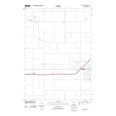
2010 Map of Austin West
USGS Topo · Published 2010About this map
Turtle Creek and its tributaries define the drainage of this agricultural landscape in southern Minnesota, just west of the regional center of Austin. The terrain is marked by a precise grid of rural routes, including 880th Ave and Mower-Freeborn Rd, which connect scattered farming communities. Small settlements such as Moscow and Oakland serve as local anchors, while Austin Acres indicates residential expansion on the suburban fringe.
Find a feature on this map
41 named features on this map. Tap any name to fly to it.
Don’t see what you’re looking for? This feature index may not catch every label — zoom into the map to look around manually.
Map Details
Editions of this 2010 Austin West Map
This is the sole edition of this map. No revisions or reprints were ever made.
Other maps of this area

1954 · Hayward
USGS Topo · 1:62,500

1954 · Austin
USGS Topo · 1:62,500

1954 · Mason City
USGS Topo · 1:250,000

1957 · Mason City
USGS Topo · 1:250,000

1958 · Mason City
USGS Topo · 1:250,000

1966 · Waltham
USGS Topo · 1:24,000

1967 · Blooming Prairie
USGS Topo · 1:24,000

1967 · Hollandale
USGS Topo · 1:24,000
1982 · Austin East
USGS Topo · 1:24,000

1982 · Hayward
USGS Topo · 1:24,000