
1964 Map of Austonio
USGS Topo · Published 1967About this map
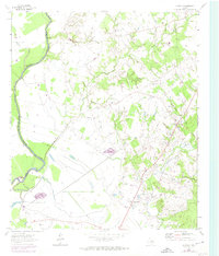
The Trinity River forms the western boundary of this territory, where the bottomlands transition into the higher elevations of Henderson Ridge. In the mid-1960s, this pocket of East Texas remained a landscape of dispersed agricultural communities and rural congregations. The settlement of Austonio serves as a local hub, flanked by smaller hamlets like Ash and Mapleton. The density of community landmarks provides deep genealogical value, with several rural houses of worship including Mt Zion Ch, Monticello Ch, and Pleasant Grove Ch.
Find a feature on this map
22 named features on this map. Tap any name to fly to it.
Don’t see what you’re looking for? This feature index may not catch every label — zoom into the map to look around manually.
Map Details
Editions of this 1964 Austonio Map
2 editions found
Other maps of this area

1953 · Palestine
USGS Topo · 1:250,000

1957 · Palestine
USGS Topo · 1:250,000

1964 · Sand Ridge
USGS Topo · 1:24,000

1964 · Porter Springs
USGS Topo · 1:24,000

1964 · Pearsons Chapel
USGS Topo · 1:24,000

1964 · Eunice
USGS Topo · 1:24,000

1964 · Middleton
USGS Topo · 1:24,000
1964 · Weldon
USGS Topo · 1:24,000

1964 · Halls Bluff
USGS Topo · 1:24,000
1964 · Elwood
USGS Topo · 1:24,000