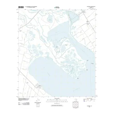
2010 Map of Austwell
USGS Topo · Published 2010About this map
Austwell sits at the junction of Hynes Bay and San Antonio Bay, serving as a coastal gateway where the land meets a complex network of marshes and tidal lakes. The landscape is defined by the delta of the Guadalupe River, which splits into the North Guadalupe River and South Guadalupe River as it approaches the coast. This environment is characterized by large named islands like Kamey Island and Kenyon Island, as well as numerous interior water bodies including Mission Lake and Long Lake. Industrial and transport needs are represented by the Victoria Barge Canal cutting through the marshlands toward the interior. Further inland, the settlement of Long Mott and several rural airfields, such as the Whatley Flying Service Airport, indicate a region balancing coastal industry with agricultural aviation.
Find a feature on this map
54 named features on this map. Tap any name to fly to it.
Don’t see what you’re looking for? This feature index may not catch every label — zoom into the map to look around manually.
Map Details
Editions of this 2010 Austwell Map
This is the sole edition of this map. No revisions or reprints were ever made.
Other maps of this area

1952 · Mosquito Point
USGS Topo · 1:24,000

1952 · Tivoli
USGS Topo · 1:24,000

1952 · Bloomington SW
USGS Topo · 1:24,000

1952 · Tivoli SE
USGS Topo · 1:24,000

1952 · Austwell
USGS Topo · 1:24,000

1952 · Seadrift
USGS Topo · 1:24,000

1952 · Port Lavaca West
USGS Topo · 1:24,000

1952 · Tivoli SW
USGS Topo · 1:24,000

1952 · Green Lake
USGS Topo · 1:24,000

1953 · Beeville
USGS Topo · 1:250,000