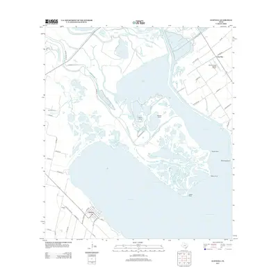
2013 Map of Austwell
USGS Topo · Published 2013About this map
Austwell and Long Mott serve as the primary residential hubs in this coastal landscape where the Guadalupe River fragments into a complex network of bayous and islands. The terrain is defined by the transition from terrestrial farm roads to the expansive waters of Hynes Bay and San Antonio Bay. Inland, the Whatley Flying Service Airport and the presence of Saint Marys Cem and Austwell Cem reflect the local community infrastructure established between the coastal marshes and the interior.
Find a feature on this map
72 named features on this map. Tap any name to fly to it.
Don’t see what you’re looking for? This feature index may not catch every label — zoom into the map to look around manually.
Map Details
Editions of this 2013 Austwell Map
This is the sole edition of this map. No revisions or reprints were ever made.
Other maps of this area

1952 · Mosquito Point
USGS Topo · 1:24,000

1952 · Tivoli
USGS Topo · 1:24,000

1952 · Bloomington SW
USGS Topo · 1:24,000

1952 · Tivoli SE
USGS Topo · 1:24,000

1952 · Austwell
USGS Topo · 1:24,000

1952 · Seadrift
USGS Topo · 1:24,000

1952 · Port Lavaca West
USGS Topo · 1:24,000

1952 · Tivoli SW
USGS Topo · 1:24,000

1952 · Green Lake
USGS Topo · 1:24,000

1953 · Beeville
USGS Topo · 1:250,000