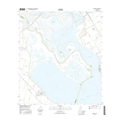
2016 Map of Austwell
USGS Topo · Published 2016About this map
The town of Austwell sits at the edge of Hynes Bay, where the coastal prairies of Refugio County meet an intricate network of marshes and delta channels. This landscape is defined by the splitting of the Guadalupe River into its north and south branches as it empties toward San Antonio Bay. The area is a complex of shallow lakes and bayous, including Mission Lake, Green Lake, and Alligator Slide Lake, which illustrate the slow movement of water across this low-lying terrain.
Find a feature on this map
71 named features on this map. Tap any name to fly to it.
Don’t see what you’re looking for? This feature index may not catch every label — zoom into the map to look around manually.
Map Details
Editions of this 2016 Austwell Map
This is the sole edition of this map. No revisions or reprints were ever made.
Other maps of this area

1952 · Mosquito Point
USGS Topo · 1:24,000

1952 · Tivoli
USGS Topo · 1:24,000

1952 · Bloomington SW
USGS Topo · 1:24,000

1952 · Tivoli SE
USGS Topo · 1:24,000

1952 · Austwell
USGS Topo · 1:24,000

1952 · Seadrift
USGS Topo · 1:24,000

1952 · Port Lavaca West
USGS Topo · 1:24,000

1952 · Tivoli SW
USGS Topo · 1:24,000

1952 · Green Lake
USGS Topo · 1:24,000

1953 · Beeville
USGS Topo · 1:250,000