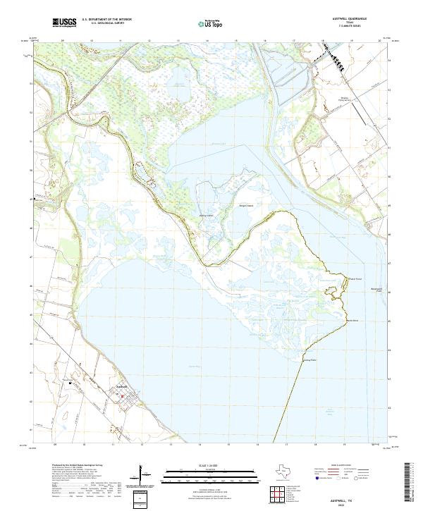
2022 Map of Austwell
USGS Topo · Published 2022About this map
Austwell sits at the southwestern edge of a vast coastal hydrologic network where the Guadalupe River fans out into a complex delta before reaching the sea. This coastal landscape is defined by the shifting boundaries of Hynes Bay and San Antonio Bay, where countless waterways like Mamie Bayou, Redfish Bayou, and Boggy Bayou weave through low-lying marshlands. The intersection of Refugio and Calhoun counties is marked here by the split of the river into the North Guadalupe River and South Guadalupe River, creating landforms such as Kamey Island and Kenyon Island.
Find a feature on this map
69 named features on this map. Tap any name to fly to it.
Don’t see what you’re looking for? This feature index may not catch every label — zoom into the map to look around manually.
Map Details
Editions of this 2022 Austwell Map
This is the sole edition of this map. No revisions or reprints were ever made.
Other maps of this area

1952 · Mosquito Point
USGS Topo · 1:24,000

1952 · Tivoli
USGS Topo · 1:24,000

1952 · Bloomington SW
USGS Topo · 1:24,000

1952 · Tivoli SE
USGS Topo · 1:24,000

1952 · Austwell
USGS Topo · 1:24,000

1952 · Seadrift
USGS Topo · 1:24,000

1952 · Port Lavaca West
USGS Topo · 1:24,000

1952 · Tivoli SW
USGS Topo · 1:24,000

1952 · Green Lake
USGS Topo · 1:24,000

1953 · Beeville
USGS Topo · 1:250,000