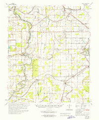
1967 Map of Auter
USGS Topo · Published 1967About this map
The Sunflower River and the Illinois Central railroad define the agricultural landscape of this Mississippi Delta region, where the borders of Humphreys, Washington, and Sharkey counties converge. The map documents a complex system of drainage ditches and bayous, including Beasley Bayou and Murphy Bayou, which support the intensive cultivation of the bottomlands. Numerous landings along the river, such as Story Ldg and Panther Bend Ldg, reflect a transition from water-based transport to rail and road networks.
Find a feature on this map
119 named features on this map. Tap any name to fly to it.
Don’t see what you’re looking for? This feature index may not catch every label — zoom into the map to look around manually.
Map Details
Editions of this 1967 Auter Map
This is the sole edition of this map. No revisions or reprints were ever made.
Other maps of this area

1939 · Lorenzen
USGS Topo · 1:62,500

1939 · Tralake
USGS Topo · 1:62,500

1939 · Swan Lake
USGS Topo · 1:62,500

1940 · Auter
USGS Topo · 1:62,500

1940 · Baird
USGS Topo · 1:62,500

1940 · Mileston
USGS Topo · 1:62,500

1953 · Greenwood
USGS Topo · 1:250,000

1954 · Mileston
USGS Topo · 1:62,500

1955 · Jackson
USGS Topo · 1:250,000

1956 · Greenwood
USGS Topo · 1:250,000