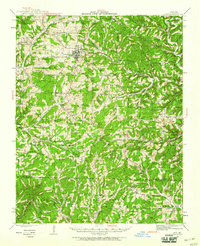
1942 Map of Ava
USGS Topo · Published 1960About this map
Ava serves as the central hub of this Missouri landscape, which is heavily defined by its deep hollows and creek systems during the mid-twentieth century. The southern portion of the quadrangle is largely occupied by the Mark Twain National Forest, where steep ridges and winding watercourses like the Little North Fork River and Pond Fork create a dense topographic pattern. This period reveals a highly localized rural infrastructure, with numerous country schools such as Nubbin Ridge Sch and Happy Home Sch spaced to serve families in isolated hollows. Cultural life is anchored by landmarks like St Marys Chapel and Turkey Creek Ch, alongside small communities such as Wasola and Smallett. The map captures the Ozark plateau before modern consolidation, preserving the locations of family-named landmarks like Sylvester Hol and Wells Hollow.
Find a feature on this map
86 named features on this map. Tap any name to fly to it.
Don’t see what you’re looking for? This feature index may not catch every label — zoom into the map to look around manually.
Map Details
Editions of this 1942 Ava Map
2 editions found
Other maps of this area

1934 · Gainesville
USGS Topo · 1:48,000

1936 · Thornfield
USGS Topo · 1:48,000

1936 · Ava
USGS Topo · 1:48,000

1937 · Buckhart
USGS Topo · 1:48,000

1937 · Bradleyville
USGS Topo · 1:48,000

1939 · Fordland
USGS Topo · 1:62,500

1940 · Gainesville
USGS Topo · 1:62,500

1942 · Fordland
USGS Topo · 1:62,500

1942 · Ava
USGS Topo · 1:62,500

1943 · Protem
USGS Topo · 1:62,500