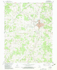
1982 Map of Ava
USGS Topo · Published 1983About this map
Ava serves as the regional hub for Douglas County, centered at the junction of Highway 5 and Highway 14. This 1982 map details a landscape transitioning from the urban center of the city, marked by the City Hall and Po, to a surrounding terrain of deeply carved hollows and prominent ridges. To the north, Martin Memorial Airport and a Drive-in Theater reflect the mid-century infrastructure of the area, while the city's eastern edge is bounded by Hunter Creek.
Find a feature on this map
61 named features on this map. Tap any name to fly to it.
Don’t see what you’re looking for? This feature index may not catch every label — zoom into the map to look around manually.
Map Details
Editions of this 1982 Ava Map
This is the sole edition of this map. No revisions or reprints were ever made.
Other maps of this area

1936 · Ava
USGS Topo · 1:48,000

1937 · Bradleyville
USGS Topo · 1:48,000

1939 · Fordland
USGS Topo · 1:62,500

1942 · Fordland
USGS Topo · 1:62,500

1942 · Ava
USGS Topo · 1:62,500

1943 · Bradleyville
USGS Topo · 1:62,500

1945 · Ava
USGS Topo · 1:62,500

1945 · Harrison
USGS Topo · 1:250,000

1945 · Bradleyville
USGS Topo · 1:62,500

1949 · Harrison
USGS Topo · 1:250,000