
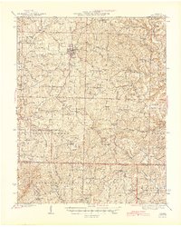
1945 Map of Ava
USGS Topo · Published 1945About this map
The Ozark plateau south of Ava is defined by a dense network of country schools and churches that once anchored these Missouri hill communities. In the mid-1940s, the landscape was divided into small townships such as Benton, Boone, and Spring Creek, where narrow ridges like Mt Calvary rise above the branching valleys of the Little North Fork White River and Hunter Creek. Local life centered around small gathering places like Arno, Squires, and Wasola. This survey captures a specific era of rural education and faith, documenting numerous local landmarks including the Walnut Grove School, St Marys Chapel, and Liberty Cemetery. Portions of the Mark Twain National Forest appear in the eastern reaches, where the terrain becomes increasingly complex near Mt Nebo.
Find a feature on this map
66 named features on this map. Tap any name to fly to it.
Don’t see what you’re looking for? This feature index may not catch every label — zoom into the map to look around manually.
Map Details
Editions of this 1945 Ava Map
2 editions found
Other maps of this area

1934 · Gainesville
USGS Topo · 1:48,000

1936 · Thornfield
USGS Topo · 1:48,000

1936 · Ava
USGS Topo · 1:48,000

1937 · Buckhart
USGS Topo · 1:48,000

1937 · Bradleyville
USGS Topo · 1:48,000

1939 · Fordland
USGS Topo · 1:62,500

1940 · Gainesville
USGS Topo · 1:62,500

1942 · Fordland
USGS Topo · 1:62,500

1942 · Ava
USGS Topo · 1:62,500

1943 · Protem
USGS Topo · 1:62,500