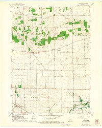
1961 Map of Avalon
USGS Topo · Published 1964About this map
Agricultural fields and scattered farmsteads define this portion of Rock County in the early 1960s, where the rural landscape is punctuated by small crossroads settlements like Johnstown Center and Avalon. The southern section is marked by the route of the Chicago Milwaukee St Paul and Pacific railroad, which skirts the edge of Bradford township near Bradford Sch. Local history is anchored by several rural burial grounds, including North Johnstown Cem and Johnstown Cem, serving the surrounding farming community.
Find a feature on this map
21 named features on this map. Tap any name to fly to it.
Don’t see what you’re looking for? This feature index may not catch every label — zoom into the map to look around manually.
Map Details
Editions of this 1961 Avalon Map
2 editions found
Other maps of this area

1891 · Koshkonong
USGS Topo · 1:62,500

1892 · Whitewater
USGS Topo · 1:62,500

1893 · Delavan
USGS Topo · 1:62,500

1893 · Whitewater
USGS Topo · 1:62,500

1893 · Shopiere
USGS Topo · 1:62,500

1894 · Koshkonong
USGS Topo · 1:62,500

1903 · Whitewater
USGS Topo · 1:62,500

1906 · Koshkonong
USGS Topo · 1:62,500

1924 · Whitewater
USGS Topo · 1:62,500

1954 · Rockford
USGS Topo · 1:250,000