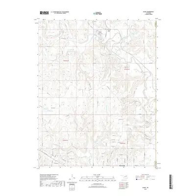
2018 Map of Avant
USGS Topo · Published 2018About this map
Avant sits at the northern edge of this Osage County landscape, where the waters of Bird Creek and Candy Cr converge. The topography is defined by the winding drainages of Quapaw Cr and its various forks, including the W Prong Quapaw Cr and E Prong Quapaw Cr. Local infrastructure is concentrated around the small town site, featuring the Candy Lake Estate Airport and the nearby Avant Water Supply Lake. To the south, the map reaches into the northern margins of Skiatook, providing a detailed view of the transitional terrain between these two communities during the early 21st century. Genealogists will find the locations of Avant Cem and Lombard Cem significant for tracing local family history in this portion of Oklahoma, while the inclusion of numerous numbered reservoirs like 113068 Reservoir illustrates the managed hydrology of the rural countryside.
Find a feature on this map
91 named features on this map. Tap any name to fly to it.
Don’t see what you’re looking for? This feature index may not catch every label — zoom into the map to look around manually.
Map Details
Editions of this 2018 Avant Map
This is the sole edition of this map. No revisions or reprints were ever made.
Other maps of this area

1901 · Claremore
USGS Topo · 1:125,000

1901 · Nowata
USGS Topo · 1:125,000

1909 · Pawhuska
USGS Topo · 1:125,000

1910 · Pawhuska
USGS Topo · 1:125,000

1912 · Hominy
USGS Topo · 1:125,000

1914 · Nowata
USGS Topo · 1:125,000

1914 · Claremore
USGS Topo · 1:125,000

1915 · Hominy
USGS Topo · 1:125,000

1916 · Claremore
USGS Topo · 1:125,000

1954 · Tulsa
USGS Topo · 1:250,000