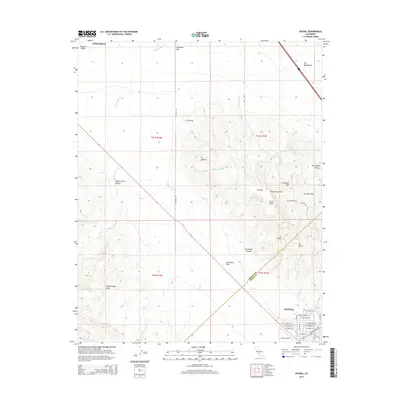
2015 Map of Avenal
USGS Topo · Published 2015About this map
The city of Avenal anchors the southeastern corner of this map, revealing a precise residential grid defined by streets such as Skyline Blvd and E Alpine St. This modern survey illustrates the complex geography where the San Joaquin Valley meets the inner Coast Ranges. The terrain is dominated by the prominent Kettleman Hills, featuring distinctive peaks and formations like North Dome, Elephant Hill, and La Lomera. To the west, the Kettleman Plain separates these heights from the Kreyenhagen Hills. Numerous ephemeral drainages, including Arroyo Seco and Zapato Chino Cr, carve through the landscape, illustrating the hydraulic patterns of this arid region. The presence of the Avenal Airport and proximity to Coalinga suggest the area's ongoing importance as a regional hub for aviation and transit within the Central Valley.
Find a feature on this map
52 named features on this map. Tap any name to fly to it.
Don’t see what you’re looking for? This feature index may not catch every label — zoom into the map to look around manually.
Map Details
Editions of this 2015 Avenal Map
This is the sole edition of this map. No revisions or reprints were ever made.
Other maps of this area

1912 · Coalinga
USGS Topo · 1:125,000

1914 · Cholame
USGS Topo · 1:125,000

1915 · Cholame
USGS Topo · 1:125,000

1917 · Cholame
USGS Topo · 1:125,000

1930 · Discovery Well
USGS Topo · 1:31,680

1930 · Canoas Creek
USGS Topo · 1:31,680

1930 · Kettleman Plain
USGS Topo · 1:31,680

1933 · Huron
USGS Topo · 1:31,680

1933 · Guijarral Hills
USGS Topo · 1:31,680

1933 · Kettleman Plain
USGS Topo · 1:31,680