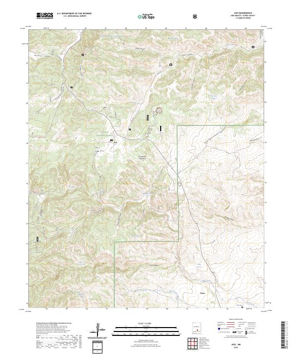
2023 Map of Avis
USGS Topo · Published 2023About this map
Avis and Pinon serve as the primary focal points of this high-altitude landscape in the southern Sacramento Mountains. Located partly within the Lincoln National Forest, the terrain is defined by a dense network of canyons and water-management features essential for ranching and settlement in this arid environment. The map shows numerous cattle tanks, such as Railsplitter-Number One Tank and Lardhole Tank, which suggest a localized economy focused on livestock. Geographically, the area is carved by significant drainages including Bluewater Canyon and Antelope Canyon, while the southern portion transitions toward the Piñon Creek basin. For genealogists, the inclusion of the Avis Cem and Piñon Cem provides important anchors for family history research in this part of Otero County.
Find a feature on this map
38 named features on this map. Tap any name to fly to it.
Don’t see what you’re looking for? This feature index may not catch every label — zoom into the map to look around manually.
Map Details
Editions of this 2023 Avis Map
This is the sole edition of this map. No revisions or reprints were ever made.
Other maps of this area

1952 · Cloudcroft
USGS Topo · 1:62,500

1954 · Carlsbad
USGS Topo · 1:250,000

1958 · Carlsbad
USGS Topo · 1:250,000

1963 · Cornucopia Canyon
USGS Topo · 1:24,000

1963 · Robertson Canyon
USGS Topo · 1:24,000

1963 · Woodson Canyon
USGS Topo · 1:24,000

1965 · Chimney Lake
USGS Topo · 1:24,000

1965 · Bear Spring
USGS Topo · 1:24,000

1965 · Surveyors Canyon
USGS Topo · 1:24,000

1965 · Avis
USGS Topo · 1:24,000