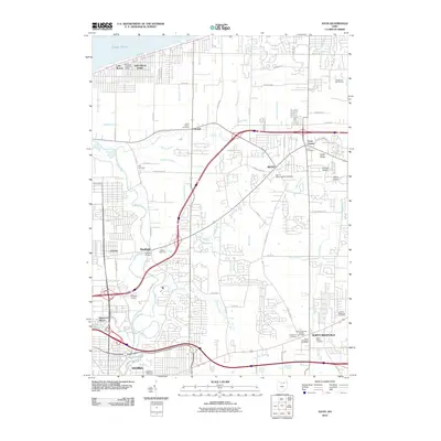
2010 Map of Avon
USGS Topo · Published 2010About this map
Lake Erie defines the northern boundary of this Lorain County landscape, where suburban expansion meets a complex network of historical water management ditches. The area is characterized by its numerous small-scale drainage systems such as Schumaker Ditch, Powdermaker Ditch, and Ziegman Ditch, which underscore the region's transition from agricultural utility to residential development. The Black River winds through the southwestern corner, spanned by the Garfield Bridge near the settlement of Sheffield.
Find a feature on this map
74 named features on this map. Tap any name to fly to it.
Don’t see what you’re looking for? This feature index may not catch every label — zoom into the map to look around manually.
Map Details
Editions of this 2010 Avon Map
This is the sole edition of this map. No revisions or reprints were ever made.
Other maps of this area

1901 · Oberlin
USGS Topo · 1:62,500

1902 · Berea
USGS Topo · 1:62,500

1903 · Oberlin
USGS Topo · 1:62,500

1904 · Berea
USGS Topo · 1:62,500

1950 · Cleveland
USGS Topo · 1:250,000

1953 · West View
USGS Topo · 1:24,000

1953 · Grafton
USGS Topo · 1:24,000

1953 · Avon
USGS Topo · 1:24,000
1953 · North Olmsted
USGS Topo · 1:24,000

1956 · Cleveland
USGS Topo · 1:250,000