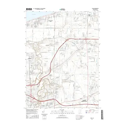
2016 Map of Avon
USGS Topo · Published 2016About this map
The Black River carves a deep, winding valley through the southwestern corner of this quadrangle, creating a dramatic corridor near Elyria that includes the Cascade Bridge and Cascade Park. Further north, the landscape levels into a dense network of suburban developments and drainage infrastructure like Klingshirn Ditch and Schumaker Ditch, which manage the low-lying terrain near the Lake Erie shoreline. This era of the mid-2010s shows a heavily utilized transportation corridor dominated by the Norfolk Southern railroad and major highways that bisect the landscape between Avon and Lorain.
Find a feature on this map
86 named features on this map. Tap any name to fly to it.
Don’t see what you’re looking for? This feature index may not catch every label — zoom into the map to look around manually.
Map Details
Editions of this 2016 Avon Map
This is the sole edition of this map. No revisions or reprints were ever made.
Other maps of this area

1901 · Oberlin
USGS Topo · 1:62,500

1902 · Berea
USGS Topo · 1:62,500

1903 · Oberlin
USGS Topo · 1:62,500

1904 · Berea
USGS Topo · 1:62,500

1950 · Cleveland
USGS Topo · 1:250,000

1953 · West View
USGS Topo · 1:24,000

1953 · Grafton
USGS Topo · 1:24,000

1953 · Avon
USGS Topo · 1:24,000
1953 · North Olmsted
USGS Topo · 1:24,000

1956 · Cleveland
USGS Topo · 1:250,000