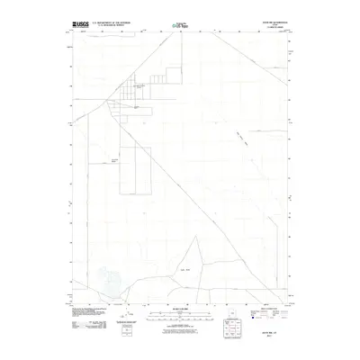
2011 Map of Avon NW
USGS Topo · Published 2011About this map
Johnston Ranch and the Sun Valley Estates Airport sit at the center of this 2011 survey, marking a pocket of development within the arid basin of Iron County. The landscape is defined by its rectilinear grid of rural roads and the intermittent drainage of Fourmile Wash and Dick Palme Wash. The presence of the Beryl Milford Rd and the Lund Hwy suggests the importance of regional connectivity across this open terrain, while the solitary rise of Table Butte to the south provides a singular topographical anchor. The crisscrossing of the Cow Trl further emphasizes the historical and ongoing use of this land for ranching and transit. This map provides a clear record of land use and property boundaries in this part of southwestern Utah during the early 21st century.
Find a feature on this map
19 named features on this map. Tap any name to fly to it.
Don’t see what you’re looking for? This feature index may not catch every label — zoom into the map to look around manually.
Map Details
Editions of this 2011 Avon NW Map
This is the sole edition of this map. No revisions or reprints were ever made.
Other maps of this area

1885 · St. George
USGS Topo · 1:250,000

1891 · St. George
USGS Topo · 1:250,000

1950 · Antelope Peak
USGS Topo · 1:24,000

1950 · Avon SE
USGS Topo · 1:24,000

1951 · Avon SE
USGS Topo · 1:24,000

1951 · Avon
USGS Topo · 1:24,000

1951 · Avon NW
USGS Topo · 1:24,000

1953 · Richfield
USGS Topo · 1:250,000

1953 · Cedar City
USGS Topo · 1:250,000

1958 · Richfield
USGS Topo · 1:250,000